 TARRANT COUNTY, TX

 Tarrant County Archives
Margaret Abbott Oliver Collection
Summary: Collection of event mementos, programs, song book, a history of the Fort Worth Post office and an orientation guide for postal employees, as well as maps.
1. "Fort Worth" ticket number 467: world premiere, Wednesday June 13, 1951, Worth Theatre
2. Souvenir bell and pin for "Fort Worth" premiere - Written on pin: "I am ringing for Fort Worth where the West begins"
3. Southwestern Exposition and Livestock Show Centennial (1996): Parking stub and souvenir pin: Centennial *Fort Worth Stock Show* Celebrating 100 Years of Heroes 1896 - 1996
4. Book: Wings of Love, songbook published by National Music Company, 3701 Avenue H, Fort Worth, Texas, 1940. Printed by A D Riley Printing Co. Fort Worth. This is a gospel songbook used by a quartet on a Sunday morning radio show, KFJZ, sponsored by Petty Optical Company. Fort Worth Post Office memorabilia
5. History of the Fort Worth Post Office, 1856-1980 printed on the occasion of the dedication of the State historical marker at the downtown post office at Lancaster.
6. Program: Dedication Texas State Historical Marker: Main Post Office Building, Fort Worth
7. Envelope from marker dedication with historical cancellation
8. Envelope from Grand Opening: Old Tyme Postique, July 20, 1980
9. First day of Issue Ceremony, Olympics International Airmail, December 1, 1979, Tarrant County Convention center, on occasion of Fort Worth hosting the World Gymnastics Championships
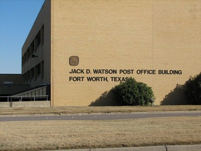
10. Program: Celebrating a new home and a memory at Christmas, Jack D. Watson General Mail Facility, 1986
11. Napkin: Dedication ceremony and Open House: Jack D. Watson Post Office Building, May 17, 1986
12. Jack D. Watson General Mail Facility: Orientation Guide for Postal Employees
8. Envelope from Grand Opening: Old Tyme Postique, July 20, 1980
9. First day of Issue Ceremony, Olympics International Airmail, December 1, 1979, Tarrant County Convention center, on occasion of Fort Worth hosting the World Gymnastics Championships
10. Program: Celebrating a new home and a memory at Christmas, Jack D. Watson General Mail Facility, 1986
11. Napkin: Dedication ceremony and Open House: Jack D. Watson Post Office Building, May 17, 1986
12. Jack D. Watson General Mail Facility: Orientation Guide for Postal Employees
Maps:
13. Map of Fort Worth, Leon Keeble mapmaker, published by Fort Worth Chamber of Commerce, 24 by 18 inches, 1948. Map has been marked with what appears to be rural mail route numbers. Map also has a downtown occupancy map.
14. Universal's Map of Fort Worth, published by the Fort Worth Chamber of Commerce, Universal Map and Drafting Company, Fort Worth. 25 by 19 inches, 1950. There are some insect holes on the map.